GEN 3.2 AERONAUTICAL CHARTS

1. RESPONSIBLE AUTHORITY

1.1 The CAA provides a wide range of aeronautical charts for use by all types of civil aviation. The AIM produces the charts which are part of the AIP. Charts suitable for pre-flight planning and briefing are available for reference at the AIS office at Muscat International and Salalah International Airports.


1.2 The charts are produced in accordance with the provisions in the following ICAO documents:


Annex4
Aeronautical Charts.
Doc 8697
Aeronautical Chart Manual
Doc 8168
Aircraft Operations, Vol. II (Construction of visual and instrument flight procedures)
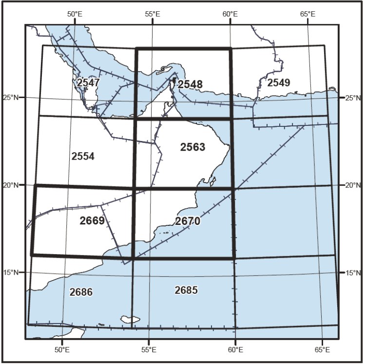
1.3 Differences from ICAO Standards Recommended Practices and Procedures are given in GEN 1.7.

2. MAINTENANCE OF CHARTS

2.1 The charts listed in 4.1 are regularly kept up to date or are replaced by AIP amendments. Significant amendments or revisions will be promulgated by AIP SUPPLEMENTS or NOTAM and included in subsequent AIP amendments, if appropriate. Information concerning new aeronautical charts will be notified by AIC.

2.2 Items of information found, after publication, to have been incorrect at the aeronautical information date are corrected immediately by NOTAM if they are of operational significance, attention being directed to that chart affected.

3. PURCHASE ARRANGEMENTS

3.1 The charts listed in 4.1 may be obtained from the:

Civil Aviation Authority
P. O. Box 1
POSTAL CODE 111
MUSCAT
Sultanate of Oman

A limited supply of these charts is also available from the NOF at Muscat Intl Airport.


4. AERONAUTICAL CHARTS SERIES AVAILABLE

4.1 The following are produced and published by the CAA:

a) Aerodrome Obstacle Chart - ICAO Type A

b) Aerodrome Obstacle Chart - ICAO Type B

c) Precision Approach Terrain Chart - ICAO

d) Enroute Charts - ICAO

e) Terminal Area Chart - ICAO

f) Standard Departure Chart Instrument (SID) - ICAO

g) Standard Arrival Chart Instrument (STAR) - ICAO

h) Instrument Approach Chart - ICAO

i) Visual Approach Chart - ICAO

j) Aerodrome Chart - ICAO

k) Aerodrome Ground Movement Chart - ICAO

l) Aircraft Parking/Docking Chart - ICAO

m) World Aeronautical Chart - ICAO 1:1 000 000

n) ATC Surveillance Minimum Altitude Chart - ICAO

Note: Not all these charts are produces for each aerodrome. Charts are produced when required in accordance with Annex 4 Standards and Recommended Practices.

4.2 General description of each series:

a) Aerodrome Obstacle Chart - ICAO Type A

These are available for ADs designated for use by international commercial air transport. The scales used are 1 : 20 000 (horizontal) and 1 : 2 000 (vertical). The charts, showing a plan and profile of each RWY (including any associated SWY and CWY), take-off flight path area, any significant obstructions and relevant declared distances, are included in AD 2.

b) Aerodrome Obstacle Chart - ICAO Type B

These charts at scale of 1:20 000 show the topography and the obstacles in the vicinity of the airport. They are intended to be used by and to assist flight crews in determination of the minimum safe altitude/height during departure and arrival phase including those for circling procedures the pre-determination of procedures for use in the event of an emergency during take-off or landing and are included in AD 2.

c) Precision Approach Terrain Chart - ICAO

These charts provide detailed terrain profile information within a defined portion of the final approach so as to enable aircraft operating agencies to assess the effect of the terrain on decision height determination by the use of radio altimeters. Those published are included in AD 2.

d) Enroute Charts - ICAO

This chart is produced for the entire Oman FIR. The aeronautical data include all aerodrome, prohibited, restricted and danger areas and the air traffic service systems in detail. The chart provides the flight crew with information that will facilitate navigation along ATS routes in compliance with air traffic services procedures.

e) Terminal Area Chart - ICAO

These are available for Muscat TMA and depict arrival, departure and transit routes and holding patterns. They are designed to facilitate transition between Radio Navigation Charts and Instrument Approach Charts and are included in AD 2.

f) Standard Departure Chart Instrument (SID) - ICAO

These charts are produced whenever a standard departure route - instrument has been established and cannot be shown with sufficient clarity on the Area Chart - ICAO.

The aeronautical data shown include the aerodrome of departure, aerodrome(s) which affect the designated standard departure route - instrument, prohibited, restricted and danger areas and the air traffic services system. This chart provides the flight crew with information that will be enable them to comply with the designated standard departure route - instrument from the take-off phase to the enroute phase. Those published are included in AD 2.

g) Standard Arrival Chart Instrument (STAR) - ICAO

These charts are produced whenever a standard arrival route - instrument has been established and cannot be shown with sufficient clarity on the Area Chart - ICAO.

The aeronautical data shown include the aerodrome of landing, aerodrome(s) which affect the designated standard arrival route - instrument, prohibited, restricted and danger areas and the air traffic services system. This chart provides flight crew with information that will enable them to comply with the designated standard arrival route - instrument from the enroute phase to the approach phase. Those published are included in AD 2.

h) Instrument Approach Chart - ICAO

These are available for ADs where instrument approach procedures have been established and approved by the Flight Operations Section of the CAA. A separate chart is published for each procedure showing plan and profile views of holding, approach and missed approach, radio facilities and relevant topographical information. Those published are included in AD 2.

i) Visual Approach Chart - ICAO

These are designed to provide pilots with a graphic presentation of approaches to ADs by visual reference, whether or not previous reference has been made to either a Radio or Visual Navigation Chart. Those published are included in AD 2.

j) Aerodrome Chart - ICAO

These are available for ADs designated for use by international commercial air transport and are designed to facilitate ground movement between RWYs and aprons. They show a plan view of the movement area and depict visual aids, radio installations, terminal buildings, ARP, RWY marking, lighting and, at an enlarged scale TWY and apron marking.

k) Aerodrome Ground Movement Chart - ICAO

This supplementary chart shall provide flight crews with detailed information to facilitate the ground movement of aircraft to and from the aircraft stands and the parking/ docking of aircraft.

l) Aircraft Parking/Docking Chart - ICAO

This chart is produced for those aerodromes where, due to complexity of the terminal facilities, the information cannot be shown with sufficient clarity on the Aerodrome/ Heliport Chart - ICAO.

This supplementary chart provides flight crews with detailed information to facilitate the ground movement of aircraft between the taxiways and the aircraft stands and the parking/docking of aircraft. Those published are included in AD 2.

m) World Aeronautical Chart - ICAO 1 : 1 000 000

These are published by Oman Authorities and available from the Civil Aviation Authority listed in 3.1. They constitute the Oman territory. Designed for pre-flight planning and pilotage, they are constructed on the Lambert Conformal Conic Projection and depict the main planimetric features and relief data and basic aeronautical information.

n) ATC Surveillance Minimum Altitude Chart - ICAO

This chart is supplementary to the Area Chart and provides information which will enable flight crews to monitor and cross-check altitudes assigned while under radar control.

5. LIST OF AERONAUTICAL CHARTS AVAILABLE

A list of the available aeronautical charts can be found in the table below,
ENR 6 and appropriate AD 2.24 sections.

TITLE OF SERIES SCALE CHART NAME AND/OR NUMBER PRICE PER SHEET RO. DATE
World Aeronautical Chart-ICAO (WAC)
1:1 000 000
WORLD AERONAUTICAL CHART
2548-2563-2669-2670
70 OMR
5 OCT 23

6. INDEX TO THE WORLD AERONAUTICAL CHART (WAC) - ICAO 1:1 000 000

7. TOPOGRAPHICAL CHARTS

Not available.

8. CORRECTIONS TO CHARTS NOT CONTAINED IN THE AIP

8.1 Amendments to aeronautical data are included in other sections of this AIP without specific reference to the charts affected. Only obstacles of a height of 100M (328 FT) or more above ground (AGL) are depicted on WAC. The coordinates used are not necessarily derived from a WGS-84 survey made to aeronautical data quality standards.

8.2 Obstacles exceeding heights of 100M (328 FT328FT) AGL reported to AIM Department that are not depicted on the WAC:, are added to ENR 5.4 or promulgated via NOTAM.

Nil